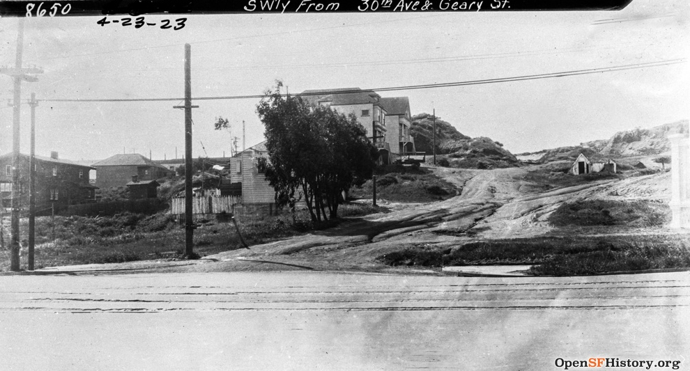
sf hills
Alamo Heights, 225 feet
aka Alamo Hill, Hayes Street Hill
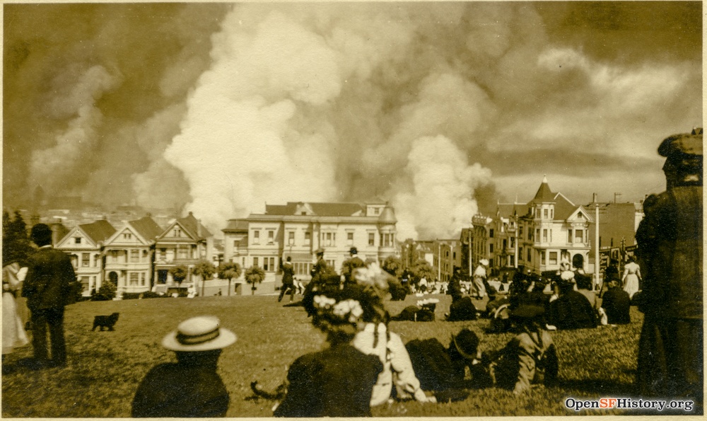
For almost 150 years, San Franciscans and tourists alike have enjoyed the banked lawns in Alamo Square Park for viewing the Seven Sisters and other wonders of the city. In this 1906 photograph with the Seven Sister at left, residents take in the post-quake inferno. Source: opensfhistory.org
Anza Vista Hill, 325 feet aka Anza Hill
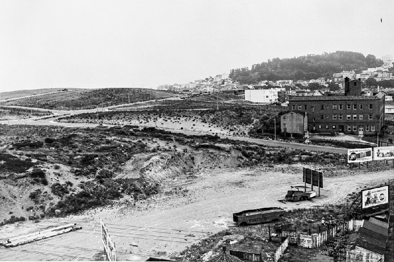
As seen in 1950 looking southeast from the Bekins Storage building. The old Calvary Cemetery site was cleared for the Anza Vista development. Site of the City Center shopping area is in the foreground. Source: opensfhistory.org
Battery Davis, 220 feet
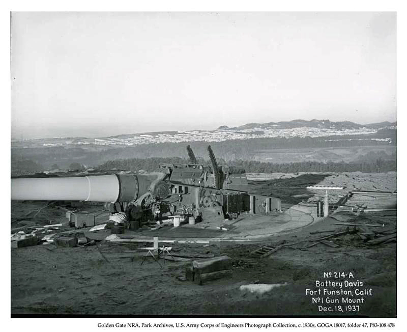
This 1937 photo shows one of two mounted guns before bunker installation. The guns were obsolete by 1948, but the bunkers still remain today. Source: San Francisco Bay Area Photo Blog
Bayshore Heights, 240 feet aka Little Hollywood Hill
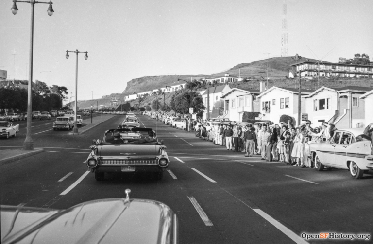
Nikita Khrushchev’s motorcade heads north on Bayshore, past Bayshore Heights in the right foreground, on his 1959 visit to San Francisco. Source: opensfhistory.org
Most San Franciscans are more familiar with the opposite side of the hill, which faces Hwy 101. The former Russia House Restaurant looms over those heading south from the city.
Bayview Hill, 425 feet aka Bay View Heights, Candlestick Hill
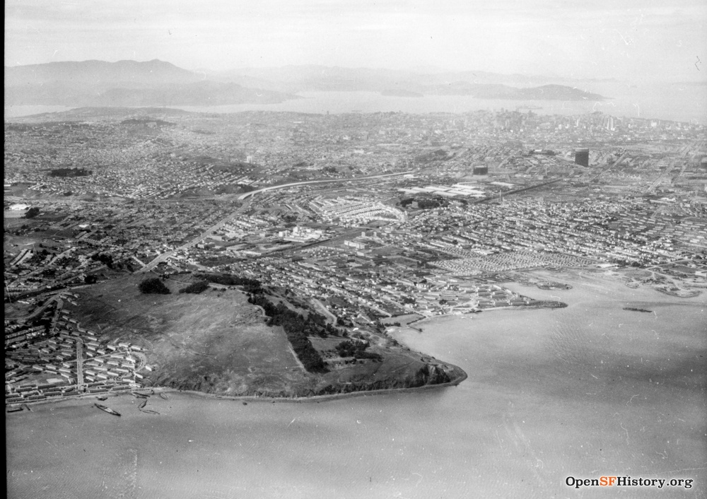
This photo from the 1950s shows that until relatively recently Bayview Hill met the Bay shoreline. Source: opensfhistory.org
Candlestick Park was later built on landfill adjacent to the hill, which for a period led to hill being referred to as Candlestick Hill.
Bernal Heights, 475 feet aka Bernal Hill
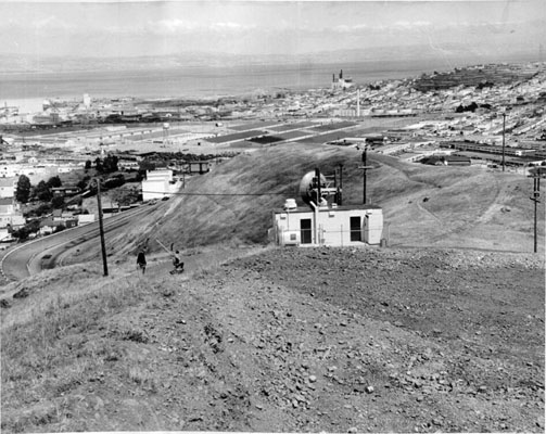
Bernal Heights photographed in 1962. Source: digitalsf.org (San Francisco Public Library)
Blue Tower Hill, 491 feet
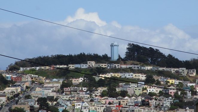
Blue Tower Hill is on the western side of McLaren Park. University Mound is on its eastern slope and the Excelsior District is on its western slope.
Blue Tower Hill photographed in 2020. Source: zontaphotos.com.
Buena Vista Heights, 575 feet aka Buena Vista Hill, fka Park Hill
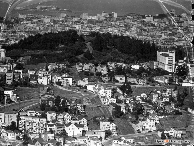
Buena Vista Heights was the only naturally verdant park in the city. This photograph from 1936 was taken from Twin Peaks. Source: opensfhistory.org
Castro Hill, 407 feet
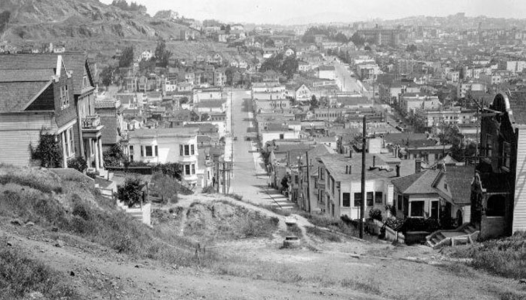
Looking down Collingwood Street towards Corona Heights in this 1927 photograph. Source: opensfhistory.org
Cathedral Hill, 200 feet
More civic development than actual hill, Cathedral Hill sits on the southern slope of Lafayette Heights. The area was first dedicated in 1965, which explains its omission from maps and hill lists until relatively recently. This 1971 photograph shows the then new St. Mary’s Cathedral at Geary and Gough. Source: opensfhistory.org

City College Hill, 350 feet
Photo taken c. 1935. Source: opensfhistory.org
Clarendon Heights, 850 feet
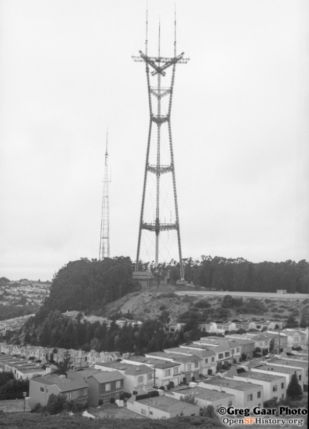
The base of Sutro Tower is mounted on the summit of Clarendon Heights. This 1974 photo was taken shortly after the completion of the tower. Source: opensfhistory.org; copyright Greg Gaar Photo
College Hill, 200 feet
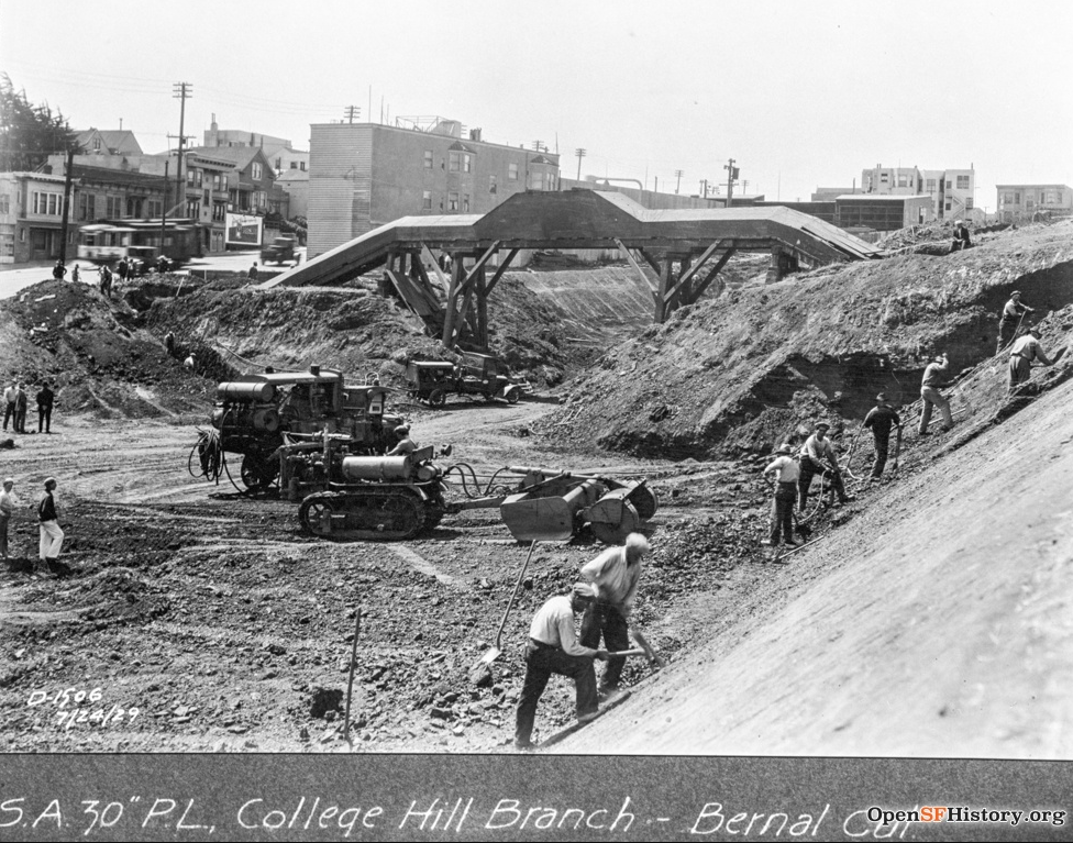
St. Mary’s College (now located in Moraga, California) was located on this hill and served as its namesake.
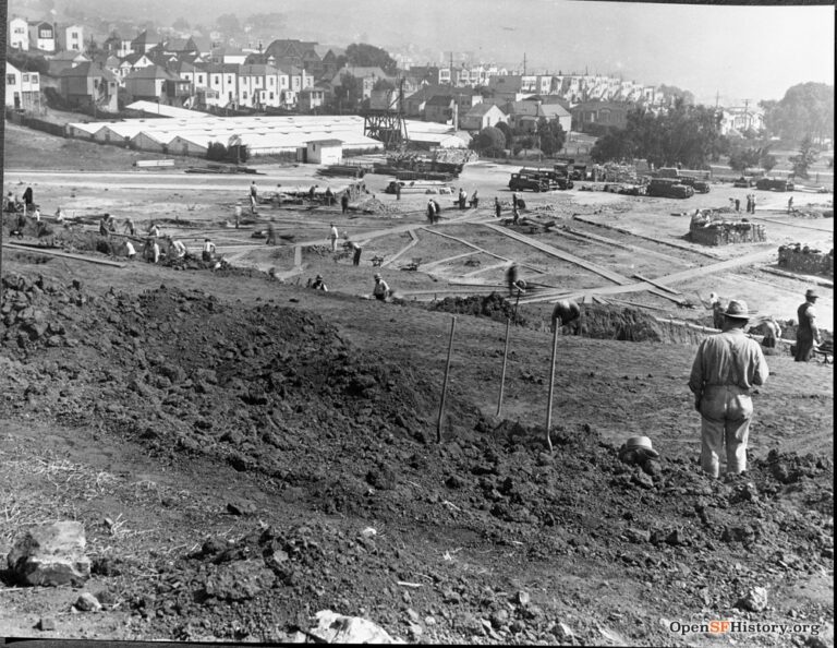
The hill was physically carved in two by the Bernal Cut, which is now San Jose Ave. Work on the Bernal Cut is shown in this 1927 image. Source: opensfhistory.org
Corona Heights, 510 feet fka as Rock Hill
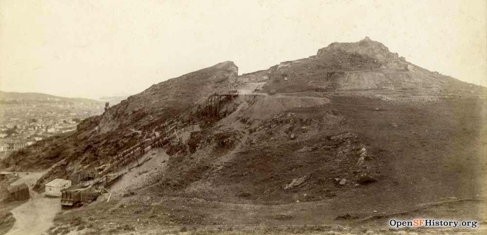
This 1899 photograph shows early quarry excavation. Source: opensfhistory.org
Crocker Amazon Hill, 225 feet
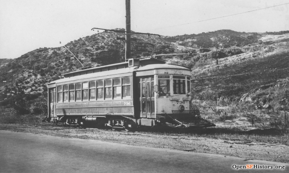
Looking at the hill from Geneva near Brookdale in this 1937 photograph. Source: opensfhistory.org
Dolores Heights, 400 feet aka Noe Hill
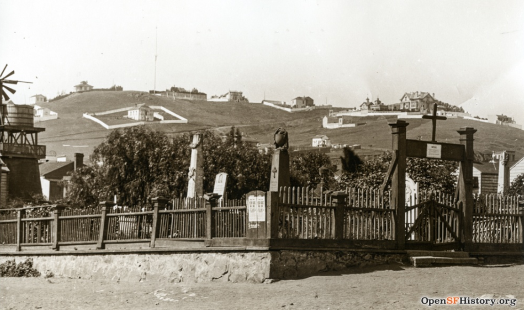
This c. 1880 photo of the Mission Dolores Cemetery features Dolores Heights in the background. The white house just left of center on the ridgeline is located on 21st Street, between Noe and Sanchez. Source: opensfhistory.org
Double Rock Hill, 75 feet
Taking its name from the Double Rock formation just offshore in the Bay, the entirety of the hill is topped by Alice Griffith Housing, which is in the midground of this 1946 photo taken from from Bayview Hill. Source: opensfhistory.org.
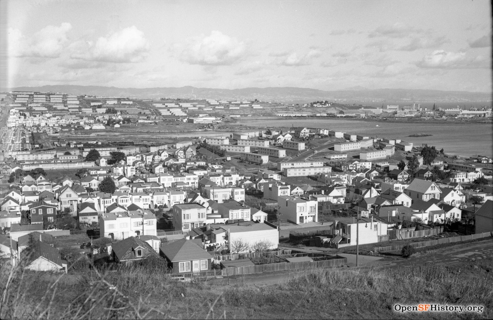
Duncan Hill, 425 feet
The hillside on the right of this c. 1940 photo is now the Castro-Duncan Open Space. Source: opensfhistory.org
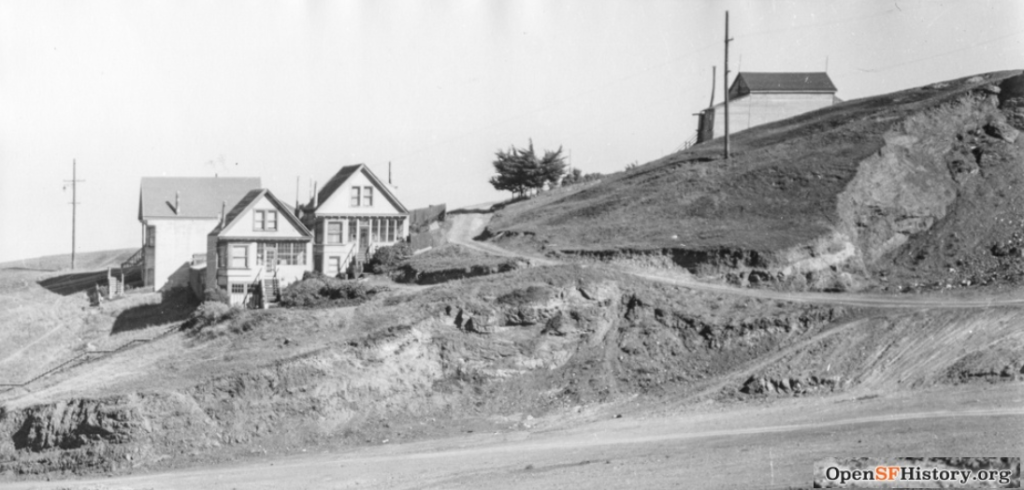
Edgehill Mountain, 700 feet aka Edgehill Heights
1973 photo. Source: opensfhistory.org
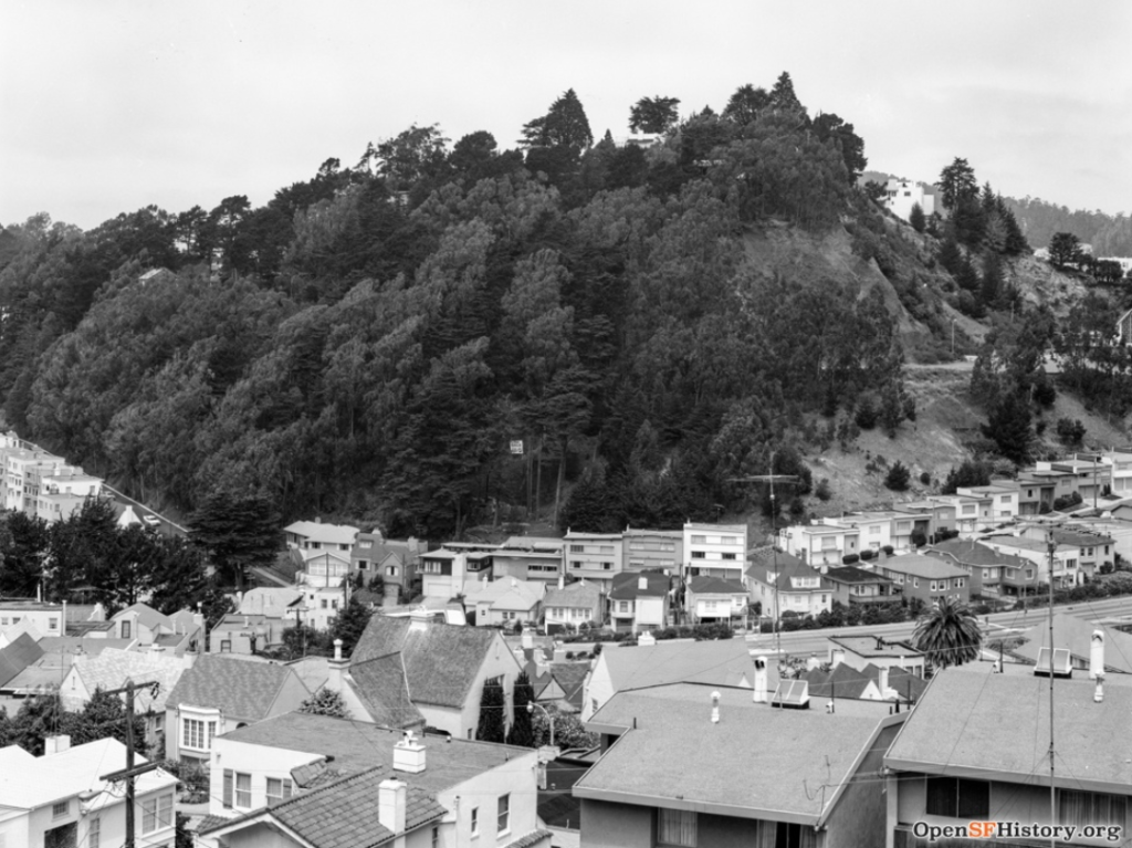
Fairmount Heights, 550 feet
Easternmost peak of Diamond Heights, at Everson Street. Billy Goat Hill is part of its northern slope.
c. 1930s photo. Source: opensfhistory.org
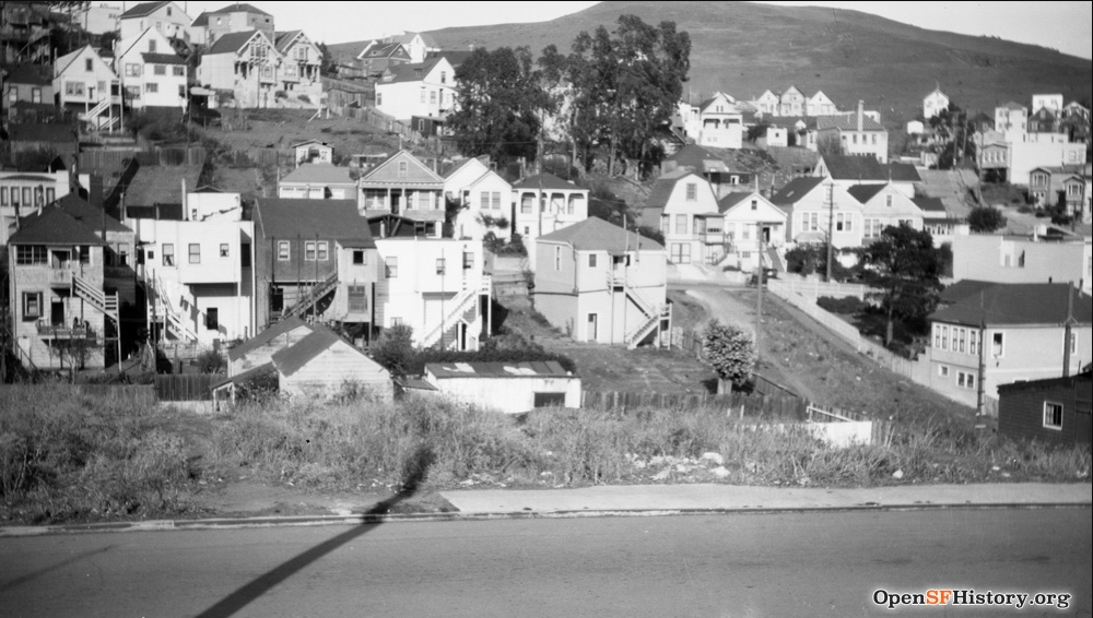
Forest Hill 775 feet fka Mount Parnassus
Today the summit is topped by municipal water towers. Hawk Hill is its southwest slope.
Shown in 1945. Source: digitalsf.org (San Francisco Public Library)
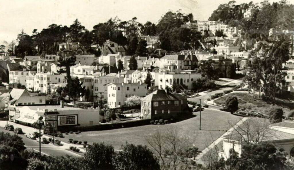
Fort Mason Hill, 111 feet
Fort Mason covers the bluff fka Black Point. Gun batteries remain at the summit.
Shown in 1927. Source: opensfhistory.org
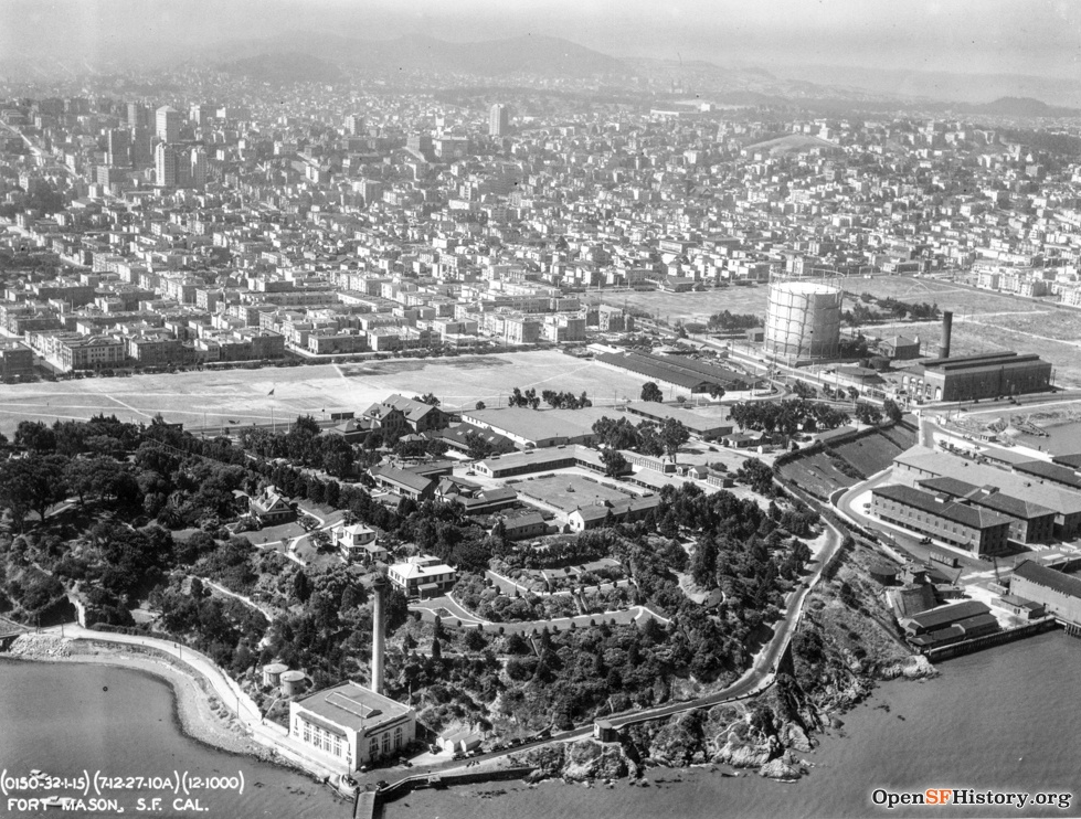
Gold Mine Hill, 679 feet
Central peak of Diamond Heights.
This 1957 photo shows O’Shaughnessy cliffs and Glen Canyon in immediate background. Source: opensfhistory.org
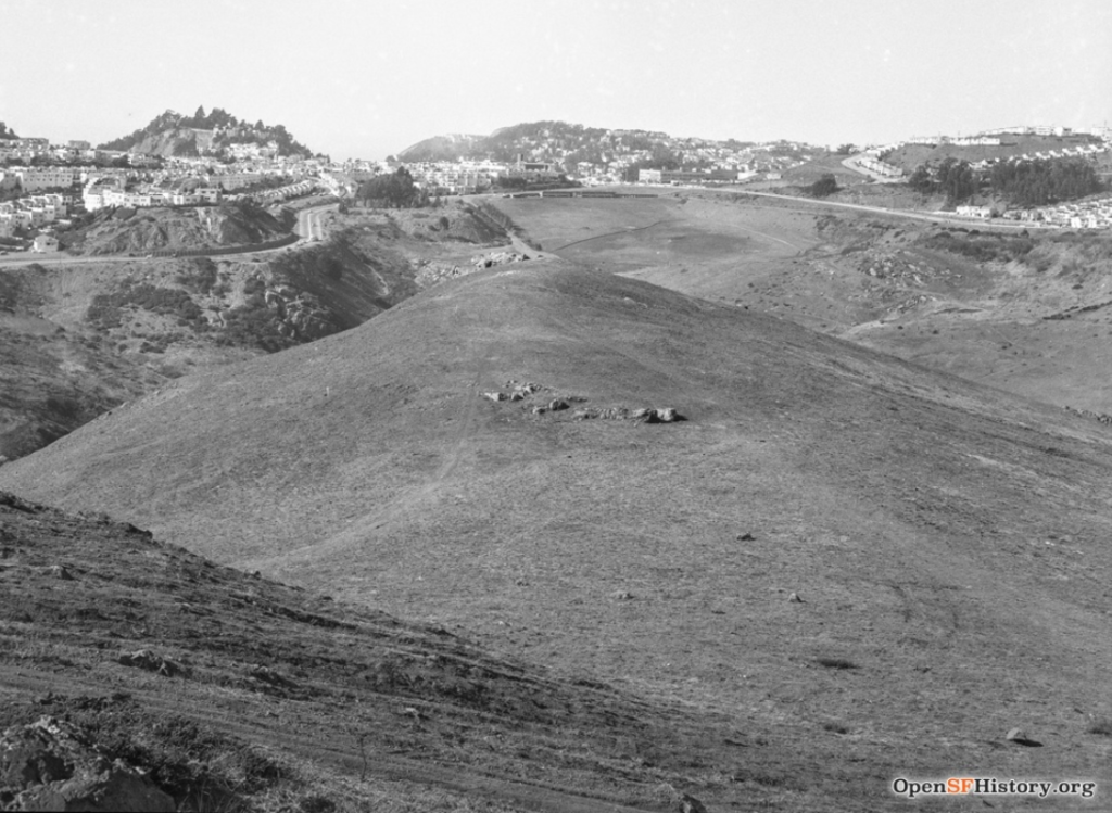
Grandview Hill, 666 feet aka Turtle Hill
Location of Grandview Park.
As seen from an observation point on Funston Ave. in this 1928 photo. Source: opensfhistory.org
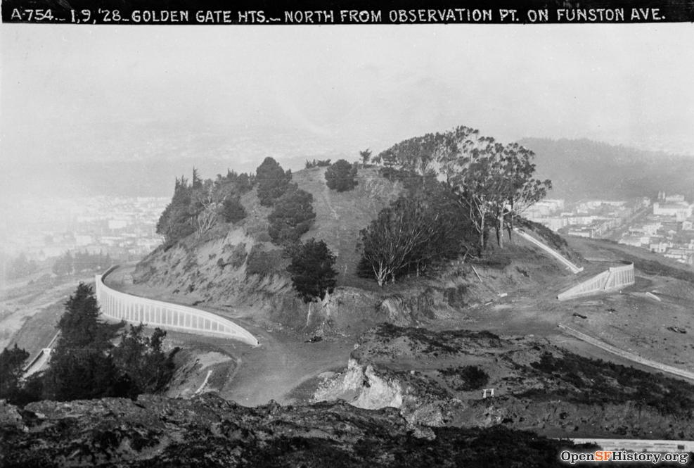
Holly Hill, 274 feet aka Holly Park Hill
Holly Park encompasses the entire summit.
Shown in 2009 photo. Source: foundsf.org
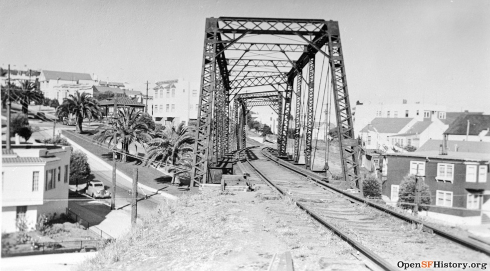
Horner’s Hill, 275 feet
Horner’s Hill is in background of this 1940s photo taken from Dolores and 27th St. The trestle is the Southern Pacific Main Line Bridge that cut through Noe Valley. Source: opensfhistory.org
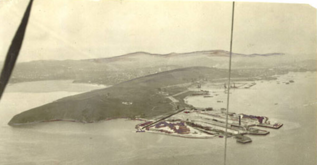
Hunters Point Ridge – Stony Hill, 275 feet
This undated aerial photo taken from an Army balloon shows the ridge prior to massive landfilling for the Naval Shipyard. Source: digitalsf.org (San Francisco Public Library)
The high point on the ridge is Stony Hill. A lower promontory on the eastern end of the ridge is now called Hunters Point Shipyard Hill.
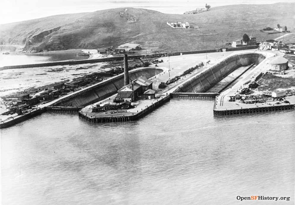
Hunters Point Shipyard Hill, 125 feet
The San Francisco Shipyard development now tops the rise, but much of the hill has been graded out of existence.
Photo c 1910. Source: opensfhistory.org
Irish Hill, 50 feet
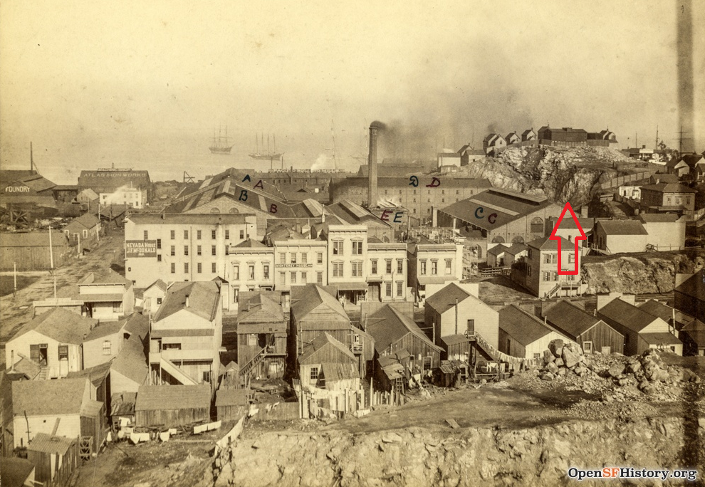
Once a complete hill, possibly 140 feet high, as can been seen in this c. 1890 photo at right. Source: opensfhistory.org
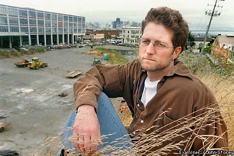
Below, the last Mayor of Dogpatch, John Borg, perched on today’s remaining nub. Copyright 1999, John Storey.
Kite Hill, 470 feet fka Pansy Hill, Poppy Hill
Topped by Brooks Park, Kite Hill is the western summit of Merced Heights ridgeline.
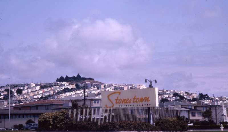
Brooks Park atop Kite Hill as seen in this 1966 photo taken from Stonestown Shopping Center. Source: outsidelands.org
La Portezuela, 450 feet
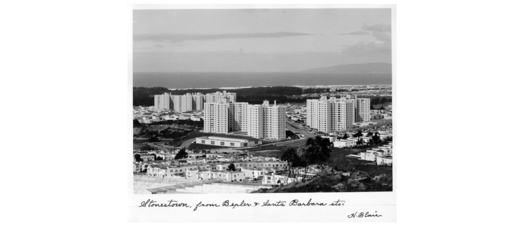
The view from Bepler in the 1950’s. Source: digitalsf.org (San Francisco Public Library)
Lafayette Heights, 378 feet aka Holladay’s Hill
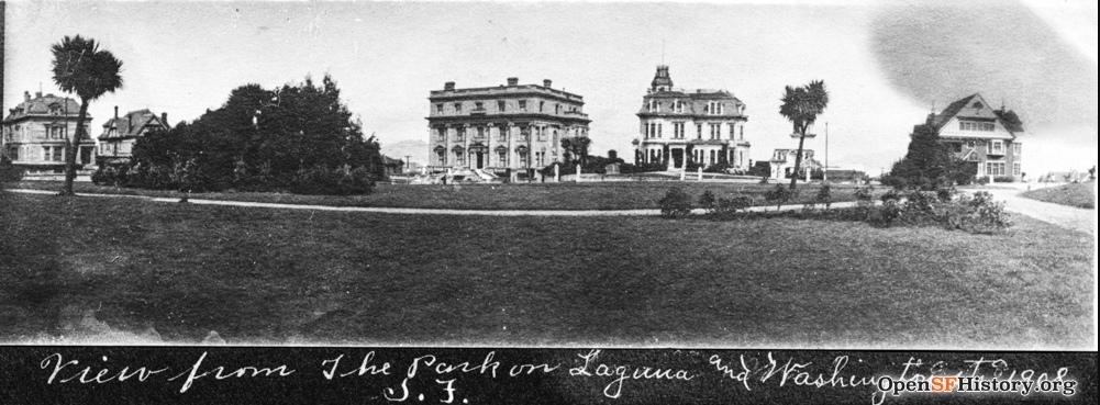
Lafayette Heights, with its summit in Lafayette Square Park, also serves as the east-end of the Pacific Heights ridge.
The view from the park with the mansions along the north side is shown in this 1908 photo. Source: opensfhistory.org
Larsen Peak, 774 feet aka Sunset Heights
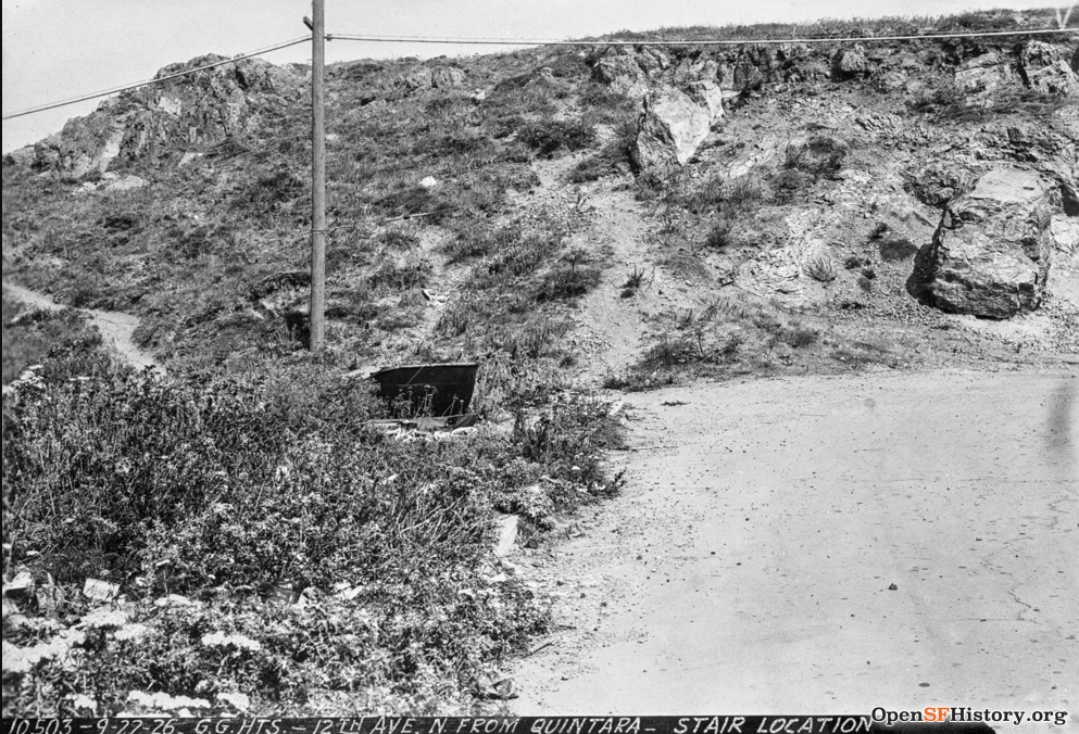
Location of Golden Gate Heights Park.
1926 photograph. Source: opensfhistory.org
Laurel Hill, 350 feet fka Laurel Hill Cemetery
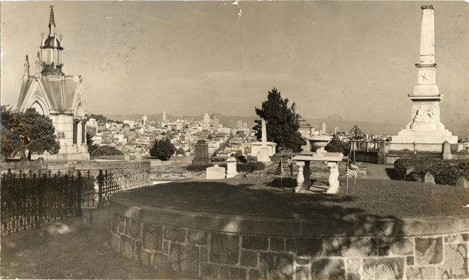
Site of the Laurel Hill Cemetery, as seen in 1940. Source: digitalsf.org (San Francisco Public Library)
Lincoln Heights, 376 feet
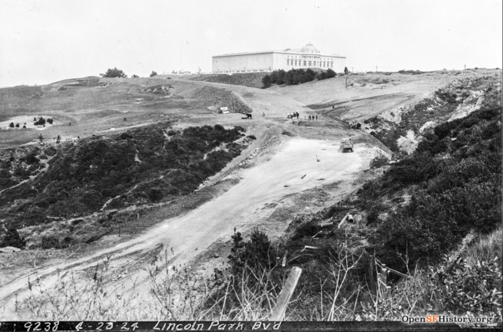
1924 photo of the Palace of the Legion of Honor in Lincoln Park. Source: opensfhistory.org.
The western terminus of the Lincoln Highway, the country’s first transcontinental highway, was just steps from the entrance of the new museum.
Little Bayview Hill, 125 feet
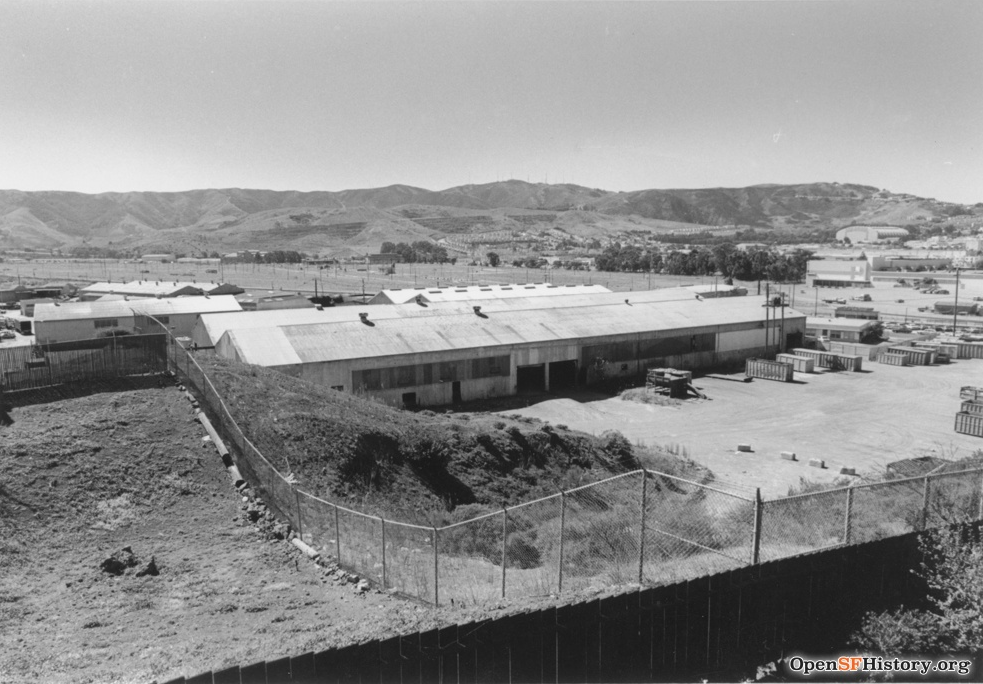
1990s photo of the hill located within Recology’s recycling center. Source: opensfhistory.org
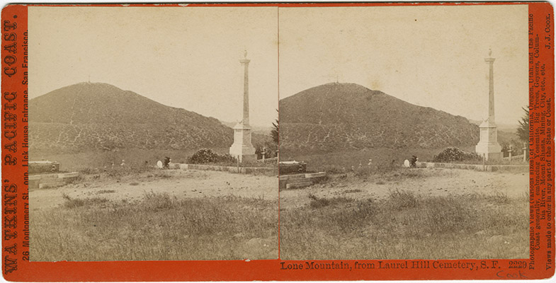
Lone Mountain, 448 feet
Lone Mountain with the Laurel Hill Cemetery in the foreground of this c. 1870 stereo image. Source: digitalsf.org (San Francisco Public Library)
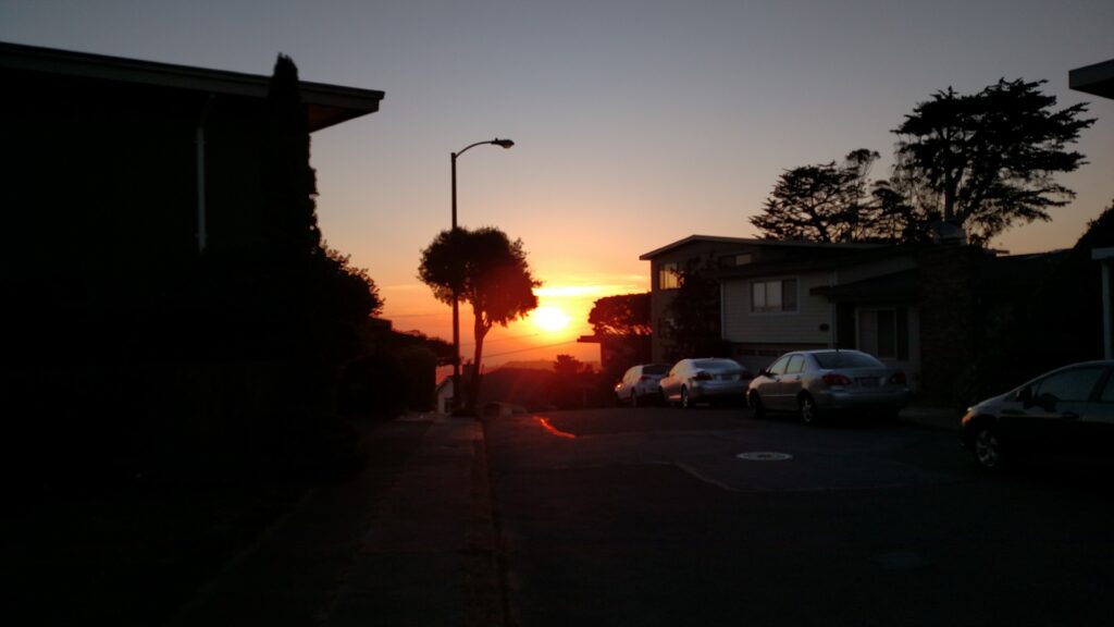
Macaroon Hill, 825 feet aka Sherwood Forest
Famous for its Pacific Ocean sunsets as seen in this 2020 photo. Copyright Shawn Sax.
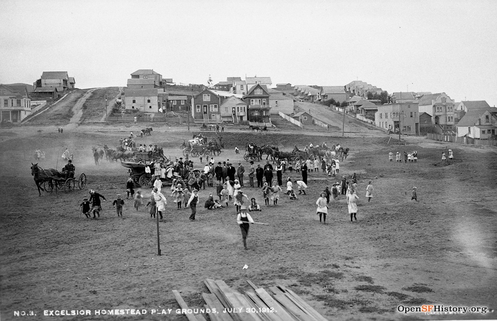
Madrid Hill, 300 feet
1912 photograph taken from the Excelsior Play Grounds, looking up Edinburgh and Madrid Streets. Source: opensfhistory.org.
Martha Hill, 350 feet
This hill at the bottom of Glen Park is virtually forgotten, covered as it is by houses and trees. In this c. 1935 photo it still is distinct from the surrounding areas. Source: opensfhistory.org.
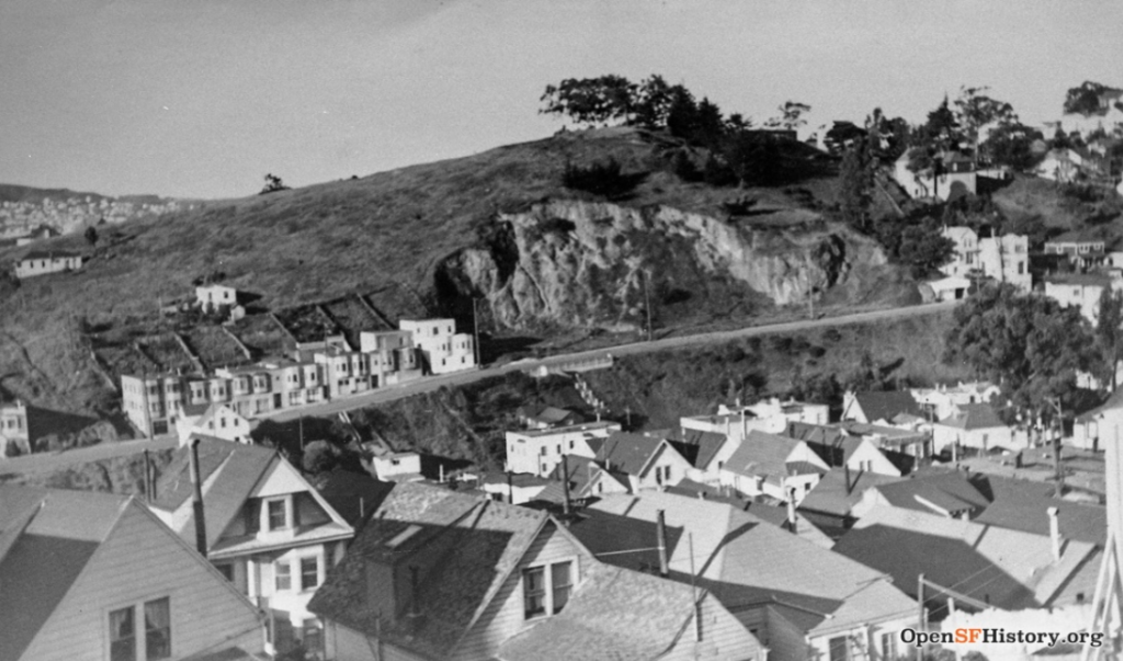
McLaren Ridge – Visitacion Knob, 525 feet
1930s photo looking across Sunnydale Ave, with the the location of the Gleneagles Golf Course in front of the ridgeline. Source: opensfhistory.org.
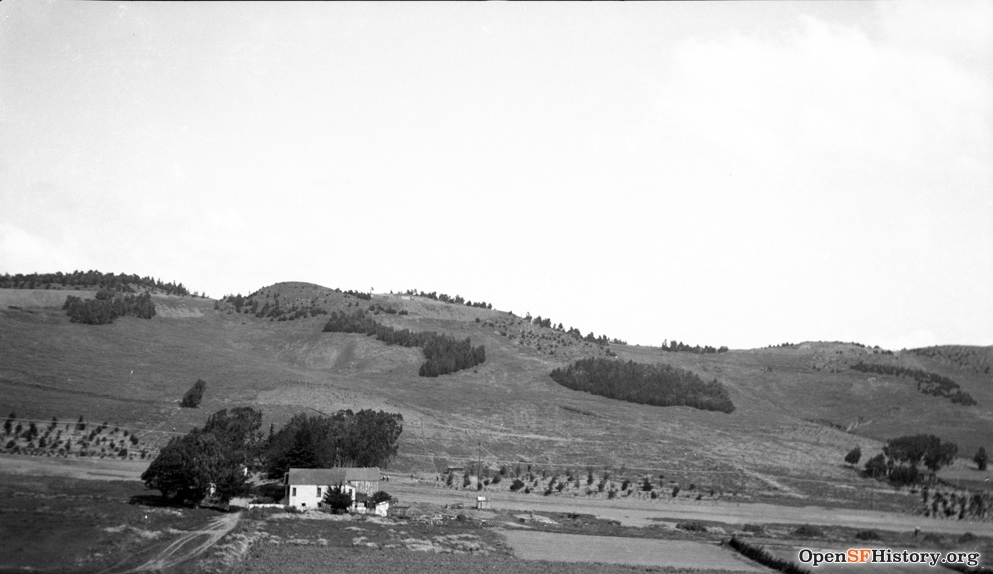
Merced Heights – Shields/Orizaba Rocky Outcrop, 500 feet aka Ingleside Heights
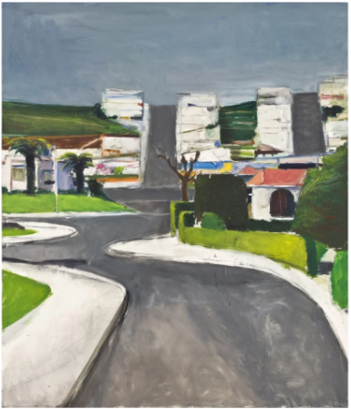
Merced Heights has three summits, the highest being the center summit at Shields/Orizaba Rocky Outcrop. The western summit is at Brooks Park and the eastern summit is at the intersection of Summit and Thrift streets.
Richard Diebenkorn was raised in the neighborhood and painted “Ingleside” in 1963.
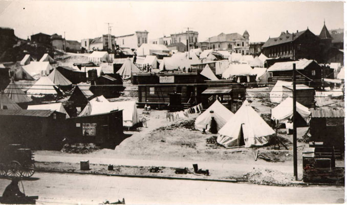
Mint Hill, 150 feet fka Clinton Mound
The US Mint building was erected on Clinton Mound in 1937, ultimately giving a new name to the area. Clinton Mound served as a tent encampment after the 1906 earthquake s seen in this photo. Source: digitalsf.org (San Francisco Public Library)
Monterey Heights, 575 feet
Already a developed community in this 1930s photo. Source: opensfhistory.org
Mount Davidson, 927 feet
The tallest hill in San Francisco is practically unknown to even most San Franciscans. Appearing on early maps as one among many promontories in the San Miguel Hills, the hill remained anonymous on maps for years past its official naming in 1911. The hill’s namesake is the incredible geographer George Davidson, who early in his career surveyed the hill and himself named it Blue Mountain (a name that later stuck for a bit on nearby Mount Sutro).
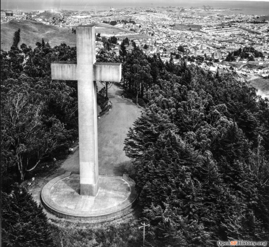
The photo at right shows the Cross and Easter celebration area c. 1958. Source: openssfhistory.org
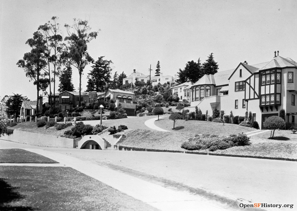
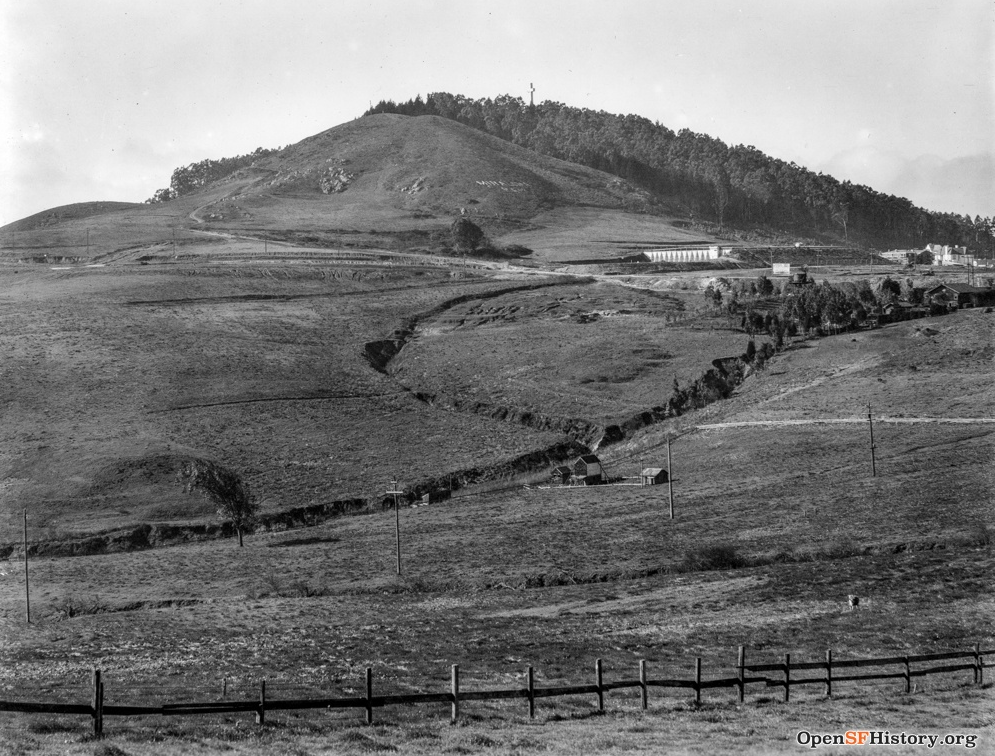
At bottom right, the photo taken c. 1926 indicates why Mount Davidson, physically located in the center of the city but seemingly in the middle of nowhere, remained anonymous for so many years. Source: openssfhistory.org
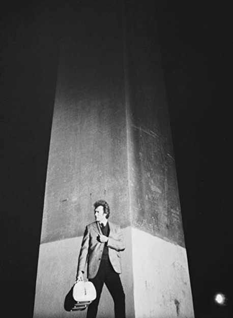
Below, Harry Callahan is seen making a delivery at the Cross in 1970.
Mount Olympus, 570 feet
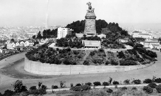
The statue is still atop the pedestal in this 1947 photo. Source: digitalsf.org (San Francisco Public Library)
Mount St. Joseph, 250 feet.
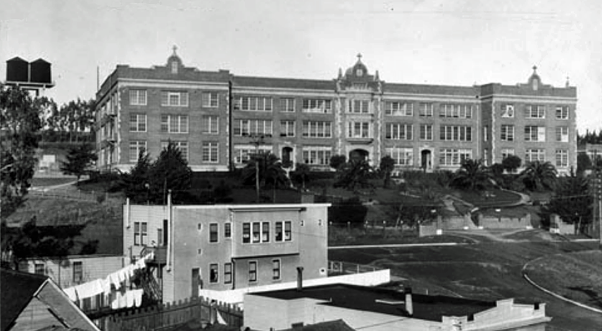
Once topped by Mount St. Joseph’s School orphanage, the hill is now topped by Silverview Terrace.
This 1929 photo shows the orphanage, which was later featured in the movie The Midnight Story, starring Tony Curtis. Courtesy of Reel SF (reelsf.com). Reel SF identifies in meticulous detail San Francisco locations used in vintage movies. Well worth a visit to the website!
Mount Sutro, 908 feet fka Blue Mountain, Mount Parnassus
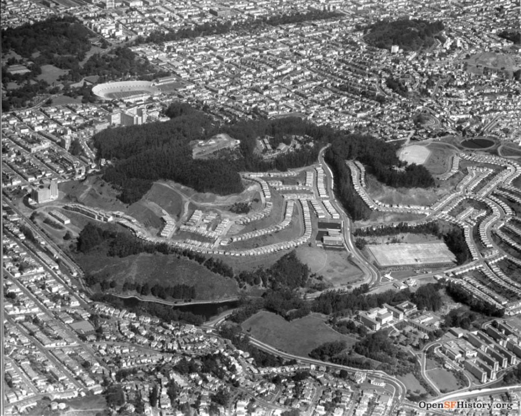
1960 aerial photograph shows Sutro Forest with development of Midtown Terrace in progress. Source: opensfhistory.org
Nob Hill, 376 feet fka Fern Hill, Clay Hill, Clay Street Hill
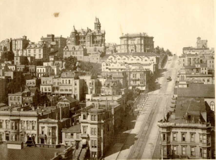
1891 photo. Source: digitalsf.org (San Francisco Public Library)
Pacheco Peak, 725 feet
This previously unnamed summit on the Golden Gate Heights ridgeline sits between Larsen Peak and Grandview Hill – seen in the foreground – of this photo from c 1949. Source: opensfhistory.org
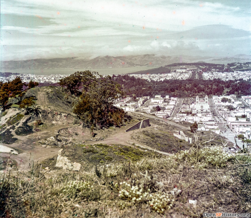
Pacific Heights – Cannon Hill, 375 feet
Cannon Hill was designated on maps as early as 1854. The hill bookends Pacific Heights along with the hill that is Lafayette Heights.
The 1918 photo taken from Broadway looks down the Lyon steps. Source: opensfhistory.org
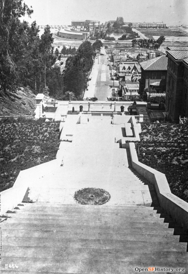
Pasadena Hill, 150 feet
The hill can be spotted in this 1950 photo. Source: opensfhistory.org
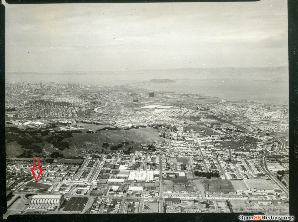
Presidio Hill, 370 feet
The hill sits within the Presidio Golf Course. Photo credit: Jason Duran (2020)
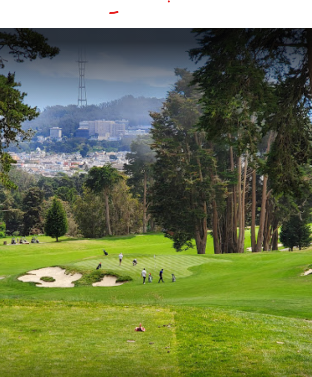
Potrero Hill, 326 feet fka Scotch Hill
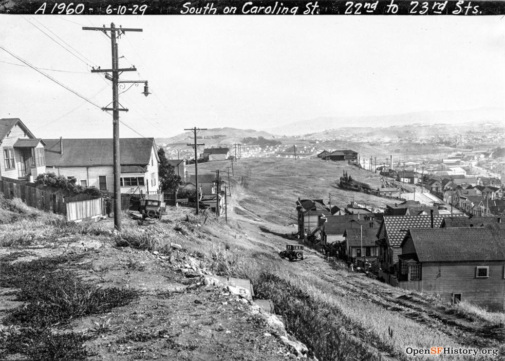
The 1929 photo at right shows Potrero Hill in its more rustic days. Source: opensfhistory.org.
Potrero Hill is now popular for its downtown views. Engagement photo below is courtesy of Emily Jenks Photography.

Red Rock Hill, 689 feet
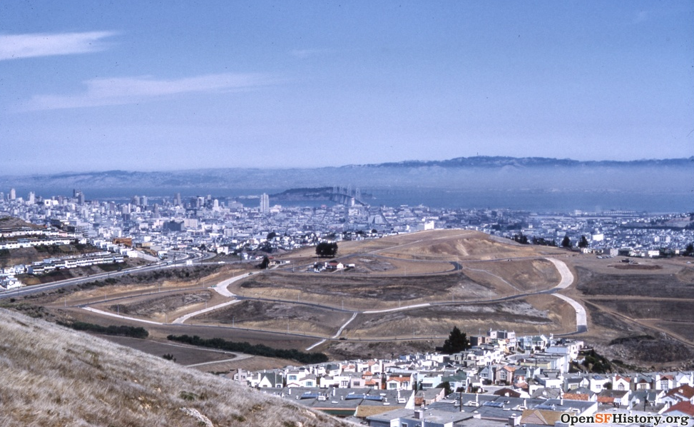
Red Rock Hill is being prepared for the Diamond Heights development in this 1961 photo. Source: opensfhistory.org
Rincon Hill, 100 feet
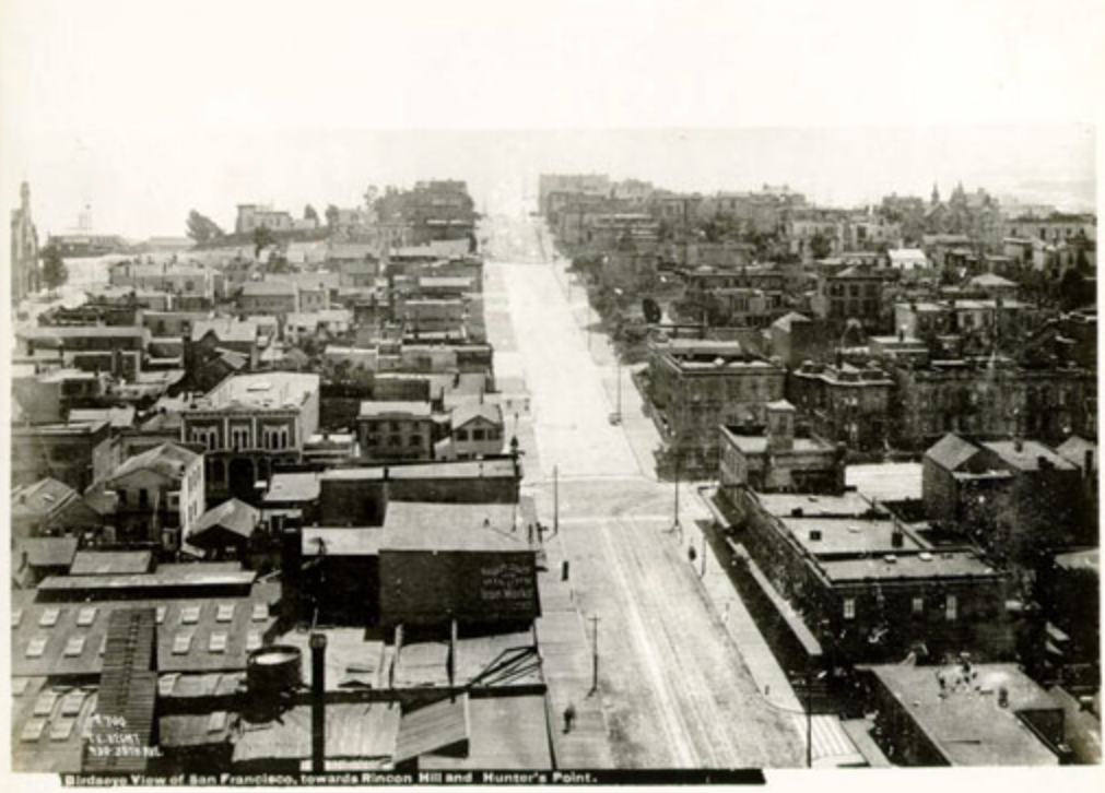
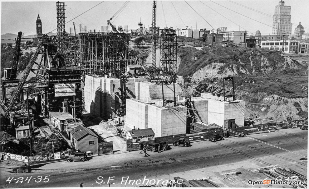
Originally about 200 feet high, Rincon Hill was an exclusive neighborhood before industry drove out the wealthy. The 1890 photo below shows the hill after some initial grading. Source: digitalsf.org (San Francisco Public Library). The 1935 photo at right shows the hill being further reduced in service as the west anchorage of the Bay Bridge. Source: opensfhistory.org
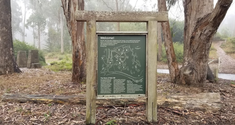
Rob Hill, 374 feet
Topped by Rob Hill Campground. Although bereft of a summit vista, Rob Hill is a beloved public campground within the city limits. Photo by Raymond Ng, 2021.
Russian Hill, 300 feet
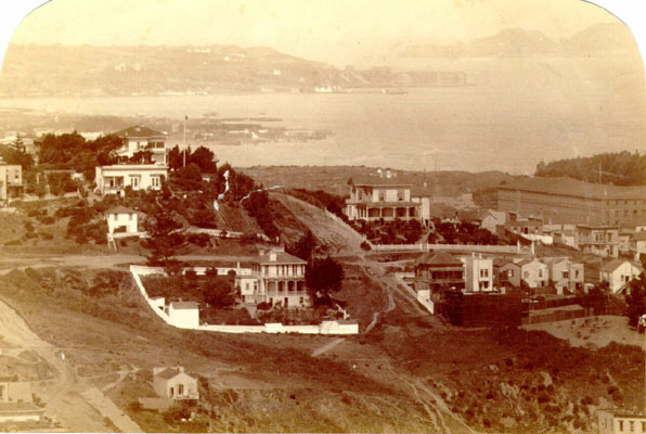
The name dates to 1847 when, as legend has it, Russian sailors were buried on the hill. The modern neighborhood of Russian Hill includes a second promontory at the Alice Marble Tennis Courts.
The 1880s photo was taken from Telegraph Hill. Source: digitalsf.org (San Francisco Public Library)
Strawberry Hill, 412 feet
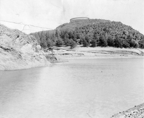
This undated photo shows the Sweeny Observatory on top of the hill, surrounded by Blue Heron Lake (formerly Stow Lake). Source: digitalsf.org (San Francisco Public Library)
Sutro Heights, 200 feet
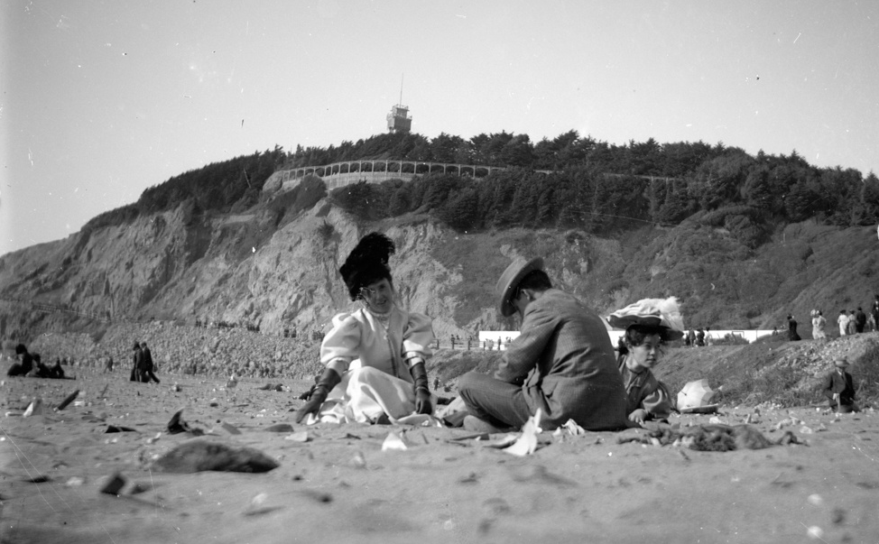
View of Sutro Heights from Ocean Beach in this 1910 photo. Source: opensfhistory.org
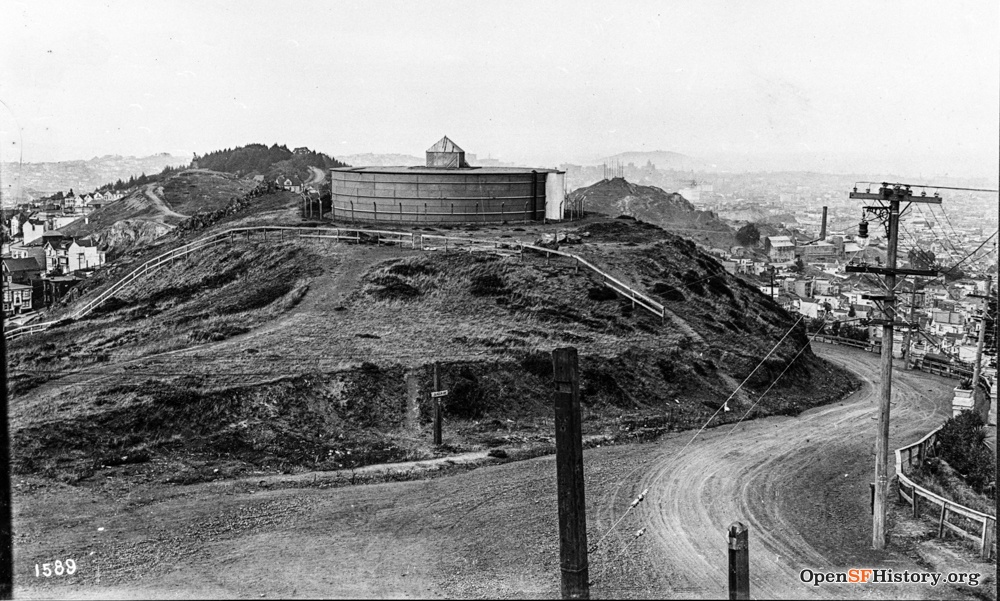
Tank Hill, 650 feet
1913 photograph. Source: opensfhistory.org
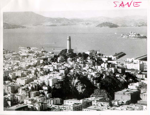
Telegraph Hill, 284 feet fka Loma Alta, Windmill Hill, Signal Hill
Aerial photograph from 1964. Source: digitalsf.org (San Francisco Public Library)
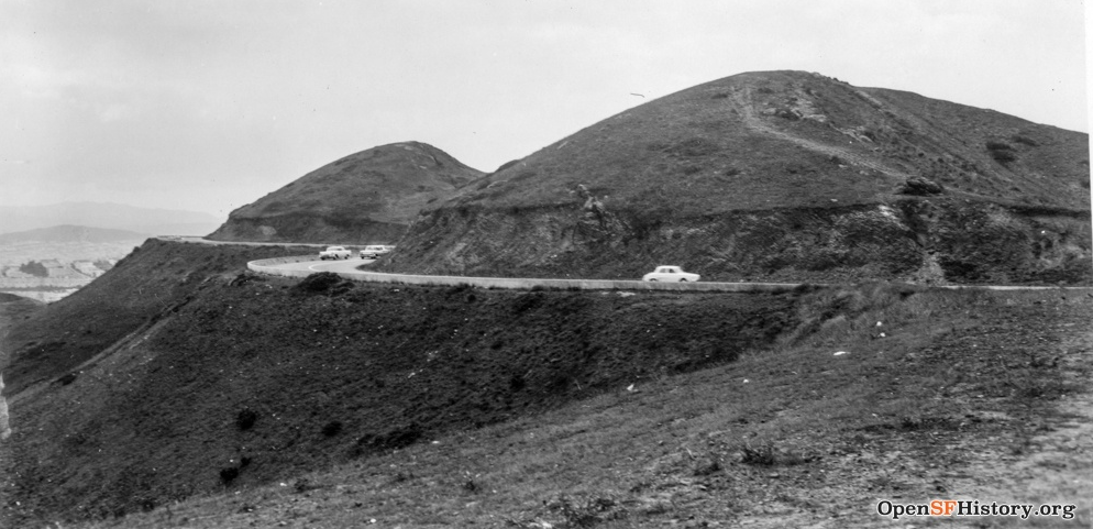
Twin Peaks
- North Peak (fka Eureka Peak), 904 feet
- South Peak (fka Noe Peak), 922 feet
1960 photo with North Peak in foreground. Source: opensfhistory.org
Washington Heights, 260 feet
1923 photo shows the future site of Washington High School. Source: opensfhistory.org
