defintive list of san francisco's hills
What follows is a complete list of San Francisco’s hills. Note: only mainland hills are included. In accessible by foot from the mainland, hills on Yerba Buena Island and the Farallon Islands are left out.
how many hills in san francisco?
Over the years various numbers have been assigned as the answer to this question. The proliferation of lists, none of which seem to be in full agreement with another, indicates this seemingly simple question may, in fact, have no answer.
In its most basic sense, a hill is a topographic protrusion that requires one to travel uphill from every direction to reach the top. If you can travel downhill to the “top,” not a hill. Some seek to define hills by applying a standard of elevation or relative prominence; however, these standards are arbitrary and most likely devised to reach a desired outcome.
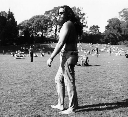
Not every hill in San Francisco is now know as a hill. Golden Gate Park is chock full of once-named 200 ft. – 325 ft. hillocks. Today, the SF Rec and Park’s GGP map identifies Strawberry Hill only, slighting Hippie Hill, ground zero for the Summer of Love and site for the most significant 420 annual celebration.
San Francisco’s own loose use of Hill, Heights and Mound also sows confusion. Locals called big slopes Hills, and real estate agents dubbed elevated and aspiring developments Heights or Mound, without concern for whether these were hills or not.
Which is to say you can pick and choose from the list of San Francisco’s hills below to come up with your own “authoritative” answer.
List of San Francisco’s Hills (Mainland) | Elev. | Summit Location |
| Alamo Heights (aka Alamo Hill, Hayes Street Hill) | 225 | Atop Alamo Square |
| Anza Vista Hill (aka Anza Hill) | 325 | Crest of Barcelona Avenue between Anza Vista and Terra Vista |
| Battery Davis | 220 | In Fort Funston, atop south gun station structure |
| Bayshore Heights (aka Little Hollywood Hill) | 240 | Crest of Lois Lane |
| Bayview Hill (aka Bayview Heights, Candlestick Hill) | 463 | Atop Bayview Park |
| Bernal Heights (aka Bernal Hill) | 475 | Atop Bernal Heights Park |
| Blue Tower Hill | 491 | La Grande Water Tank in McLaren Park (above Ina Ct.) |
| Buena Vista Heights (aka Buena Vista Hill, fka Park Hill) | 575 | Atop Buena Vista Park |
| Castro Hill | 407 | Crest of Collingwood Street (between 21st and 22nd Streets) |
| City College Hill | 350 | Science Building on Science Circle/Phelan Avenue |
| Clarendon Heights | 850 | Fence of Sutro Tower complex adjacent to resevoir |
| College Hill | 200 | Top is bounded by Mission Street, St. Mary’s Avenue, San Jose Avenue and Richland Avenue |
| Corona Heights (fka Rock Hill) | 510 | Atop Corona Heights Park |
| Crocker Amazon Hill | 225 | Undeveloped hill between Crocker-Amazon Playground and Geneva, Brookdale and Sunnydale Avenues |
| Dolores Heights (aka Noe Hill) | 400 | 21st St. between Noe and Sanchez |
| Double Rock Hill – no access | 75 | (Private Property) Hill in the Bayview District entirely topped by Alice Griffith housing |
| Duncan Hill | 425 | Noe Valley hill with its summit at the Duncan/Castro Open Space |
| Edgehill Mountain (aka Edgehill Heights) | 725 | Atop the hill |
| Fairmount Heights | 550 | Crest of Everson Street, this hill is the eastern peak of Diamond Heights |
| Forest Hill (fka Mt. Parnassus) | 788 | SF Water Towers at end of Mendosa Ave |
| Fort Mason Hill (fka Black Point) | 111 | In Fort Mason, atop gun station structure |
| Gold Mine Hill | 679 | Crest of Ora Way, this hill is the central peak of Diamond Heights |
| Grandview Hill (fka Turtle Hill) | 666 | Atop Grandview Park |
| Holly Hill (aka Holly Park Hill) | 300 | Atop Holly Park |
| Horner’s Hill | 216 | Crest of Dolores Street, at Jersey Street |
| Hunters Point Ridge – Stony Hill | 275 | Atop Hilltop Park |
| Hunters Point Shipyard Hill | 125 | Atop low hill at eastern end of Hunters Point Ridge |
| Irish Hill – no access | 50 | (Private Property) Inside PG&E yard at corner of Illinois and 22nd streets (originally 250 feet, graded for industrial use) |
| Kite Hill (fka Pansy Hill, Poppy Hill) | 470 | Topped by Brooks Park, this hill is the western summit of Merced Heights ridge |
| La Portezuela | 450 | Crest of Bepler Street, within the San Francisco/Daly City border |
| Lafayette Heights (fka Holladay’s Hill) | 378 | Atop Lafayette Square Park, this hill also is the eastern summit of Pacific Heights ridge |
| Larsen Peak (aka Sunset Heights) | 755 | Atop Golden Gate Heights Park |
| Laurel Hill (fka Laurel Hill Cemetery) | 350 | Crest of Lupine Avenue |
| Lincoln Heights | 376 | Legion of Honor museum |
| Little Bayview Hill – no access | 125 | (Private Property) Hill inside Recology Recycling Center, south of Little Hollywood Community Park |
| Lone Mountain | 413 | Main Building on Turk Street (cross is Chabot Terrace) |
| Macaroon Hill (aka Sherwood Forest) | 825 | Crest of Robinhood Drive |
| Madrid Hill | 300 | Crest at intersection of France Ave. and Madrid St (this hill previously has been misidentified as Excelsior Heights) |
| Martha Hill | 350 | Atop Dorothy Erskine Park |
| McLaren Ridge – Visitacion Knob | 528 | Visitacion Knob, off Philosopher’s Trail |
| Merced Heights – Shields Orizaba Rocky Outcrop | 535 | Atop Shields Orizaba Rocky Outcrop (aka Lakeview & Ashton Mini Park), this hill is the central summit of Merced Heights ridge |
| Mint Hill (fka Clinton Mound) | 150 | U.S. Mint building on Hermann Street |
| Monterey Heights | 575 | Crest of Rosewood Drive |
| Mount Davidson (fka Blue Mountain) | 928 | Mount Davidson Cross |
| Mount Olympus | 570 | Atop Mount Olympus Park |
| Mount St. Joseph | 250 | Crest of Bridgeview Dr. (true summit within Private Property) |
| Mount Sutro (fka Blue Mountain, Mount Parnassus) | 908 | Atop Mt. Sutro Open Space Reserve |
| Nob Hill (fka Fern Hill, Clay Hill, Clay Street Hill) | 376 | Crest at intersection of Jones and Sacramento Streets |
| Pacheco Peak | 725 | Crest of Pacheco St., between Aerial Way and Funston Ave., this peak sits between Grandview Hill and Larsen Peak on the Golden Gate Heights Ridge |
| Pacific Heights – Cannon Hill | 375 | Crest of intersection at Pacific and Lyon. Cannon Hill is the western summit of the Pacific Heights ridge. |
| Pasadena Hill | 150 | Crest of Pasadena Street |
| Potrero Hill (fka Scotch Hill) | 326 | Crest at intersection of 22nd and Wisconsin Streets |
| Presidio Hill | 370 | Crest of Deems Road, adjacent to Presidio Golf Course |
| Red Rock Hill | 689 | Crest of Red Rock Way |
| Rincon Hill | 100 | Crest at 1st and Rincon Streets (originally several hundred feet high with a posh neighborhood, the hill was repeatedly cut for streets and then the Bay Bridge anchorage) |
| Rob Hill | 374 | Atop Rob Hill Campground |
| Russian Hill | 300 | Crest of Vallejo (aka Russian Hill – Vallejo Street Crest) |
| Strawberry Hill | 412 | Sweeny Observatory ruins atop the hill |
| Tank Hill | 650 | Atop Tank Hill Park |
| Telegraph Hill (fka Loma Alta, Windmill Hill, Signal Hill) | 284 | Coit Tower |
| Twin Peaks (fka Las Papas)- North Peak (fka Eureka Peak) and South Peak (fka Noe Peak) | 910/922 | North Peak/South Peak |
| Washington Heights | 260 | Crest of intersection of 30th Ave and Anza |
| Golden Gate Park Hillocks | Elev. | Location |
| Azalea Hill | 275 | South of Rhododendron Dell |
| Bunker Hill | 200 | Across MLK Dr. from Mallard Lake |
| Casino Hill | 275 | West of Conservatory of Flowers |
| Chicken Point | 275 | Across cross JFK Dr. from Conservatory of Flowers |
| Heidelberg Hill | 250 | At Mediterranean Garden inside San Francisco Botanical Garden |
| Hippie Hill | 250 | North of Children’s Playground |
| Mount Lick | 325 | At park’s north-east corner |
| Prayerbook Cross Hill | 300 | Prayerbook Cross on JFK Dr. |
| Waterfall Hill | 300 | At back of Japanese Tea Garden |
| Whiskey Hill | 300 | Ridge between Lincoln, MLK Dr. and Kezar Way |
| Slopes and Misnomers | Reason Why Not on the Definitive List of San Francisco’s Hills |
| Ashbury Heights | Slope of Mount Olympus |
| Billy Goat Hill | Slope of Fairmount Heights, at Billy Goat Hill Park |
| Cathedral Hill | Slope of Lafayette Heights, at St. Mary’s Cathedral. Faux summit at church’s front plaza. |
| Excelsior Heights | Excelsior District rebrand. While the neighborhood is on a slope of McLaren Ridge, the name references neither Madrid Hill or Blue Tower Hill. |
| Hawk Hill | Slope of Forest Hill |
| Ignatius Heights | Shoulder of Lone Mountain, at USF campus between Fulton/Parker/Golden Gate/Masonic |
| Kite Hill | Slope of Castro Hill at open space above Yukon Street. Originally called Solari Hill by locals. |
| Lake Merced Hill | Slope of San Bruno Mountain, the bluff contained by the SF Golf Club |
| Liberty Hill | Misnomer derived from the two streets giving their names to the “Liberty-Hill Historic District” |
| Nanny Goat Hill | Slope of Dolores Heights |
| Parnassus Heights | Slope of Mount Sutro |
| Precita Heights | Slope of Bernal Heights |
| Presidio Heights | Neighborhood designation lacking its own hill. Adjacent Cannon Hill is the western summit of Pacific Heights. Presidio Hill sits inside the Presidio proper, with much of the hill within the confines of the Presidio Golf Course. |
| Silver Terrace | Slope of Mt. St. Joseph |
| Stanford Heights | Neighborhood designation lacking its own hill. Area mapped is the saddle between Mt Davidson and Twin Peaks (Stanford Heights Resevoir). |
| Sunshine Hill | Slope of Potrero Hill |
| Sutro Heights | Majestic bluff above Ocean Beach, but slope of Lincoln Heights. Faux summit atop the Parapet in Sutro Heights Park. |
| University Mound | Slope of McLaren Ridge |


